Open-Source Code
If you are interested in some methods which I developed for data fusion, cloud removal, and ETM+ image gap filling and others, please download the following codes and test data. These codes are subject to update.
(1) ESTARFM
the code (IDL and Python versions) and test data for ESTARFM algorithm (enhanced spatial and temporal adaptive reflectance fusion model, includes a fast version)
(2) NSPI
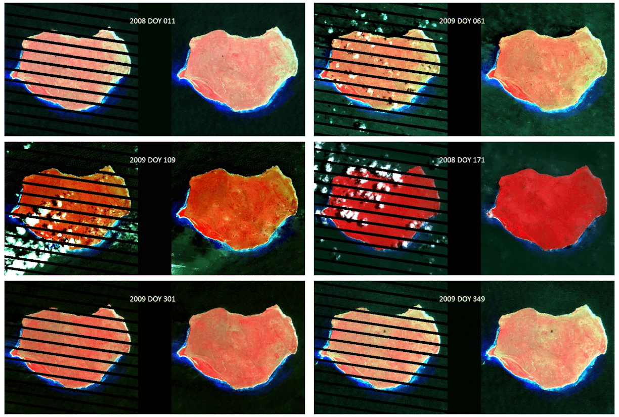
the IDL code and test data for NSPI algorithm (a Neighborhood Similar Pixel Interpolator approach for filling gaps in Landsat ETM+ SLC-off images)
(3) GNSPI
the IDL code and test data for GNSPI algorithm (a geostatistical approach for filling gaps in Landsat ETM+ SLC-off images)
(4) modified NSPI
the IDL code and test data for Cloud Remove algorithm (a modified NSPI approach for removing thick clouds in satellite images)
(5) FSDAF
the code (IDL and Python versions) and test data for fusing satellite images with different spatial and temporal resolutions (a Flexible Spatiotemporal DAta Fusion (FSDAF) method)
(6) NSPI time series
the code (IDL and Python versions) and test data for interpolating missing pixels in all images of a time series (NSPI time series)
- Download: NSPI_time_series_IDL-update_20200312.zip
- Download: NSPI_time_series_python-updated_20200627.zip
- Download: test_data.zip

(7) ATSA
the code (IDL version and Python version) and test data for ATSA algorithm (automatic screening of cloud and cloud shadow in optical image time series): download both test data zip files before unzip
- Download: atsa_idl_20190917.7z
- Download: atsa_python_20200422.7z
- Download: test_data.7z.001
- Download: test_data.7z.002
(8) SEAM
the Matlab code and test data for SEAM algorithm (A self-adjusting model for correcting the blooming effects in DMSP-OLS nighttime light images)
(9) Time series reconstruction
A package including all codes (ATSA, buffer and recode ATSA mask, and NSPI) needed for automatically reconstructing high-quality time-series images (IDL and Python versions)
(10) APA metrics
Code for computing all-round performance assessment (APA) metrics of fused images (IDL and Python codes) and R code for drawing the APA diagram
- Download: idl_code_and_sample_data_for_computing_accuracy_metrics.zip
- Download: python_code_and_sample_data_for_computing_accuracy_metrics.zip
- Download: r_code_and_sample_data_for_drawing_apa_diagram.zip
(11) Paddy Rice Index-SPRI
Code of computing SAR-based Paddy Rice Index-SPRI (R and Python versions)
- Download: python_code_rice_mapping_spri_20221202.zip
- Download: r_code_rice_mapping_spri_20220520.zip
(12) CRYSTAL
the Python code and test data for CRYSTAL algorithm (a method to remove clouds in daily nighttime light images by synergizing spatiotemporal information)
(13) OptiSAR-POM
Pond Mapping repository (GEE JavaScript) and instruction
(14) EBIA
Code and Instruction of settlement mapping using GEE JavaScript and Python.
(15) SAR-based rapeseed mapping (SARM)
Code, test data and instruction of SAR-based rapeseed mapping (SARM) using R software.
(16) SpecTF: Spectrotemporal fusion to generate frequent hyperspectral satellite imagery
Code and instruction of SpecTF using Matlab: Download
Test data: Download , password: nkfz
(17) UnmixGO: A stepwise unmixing model to address the scale gap issue present in downscaling of geostationary meteorological satellite surface temperature images
Download from Google drive
Download from Baidu Netdisk, password: 1111
(18) RESTORE-DiT: Reliable satellite image time series reconstruction by multimodal sequential diffusion transformer
(19) A cloud-regulated land surface warming model to reconstruct daytime surface temperatures under cloudy conditions
Download from Baidu Netdisk, password: 1111
Download from Google drive
(20)Daily nighttime light fluctuations index(NLFI)
-
- (1) ESTARFM
- (2) NSPI
- (3) GNSPI
- (4) modified NSPI
- (5) FSDAF
- (6) NSPI time series
- (7) ATSA
- (8) SEAM
- (9) Time series reconstruction
- (10) APA metrics
- (11) Paddy Rice Index-SPRI
- (12) CRYSTAL
- (13) OptiSAR-POM
- (14) EBIA
- (15) SAR-based rapeseed mapping (SARM)
- (16) SpecTF: Spectrotemporal fusion to generate frequent hyperspectral satellite imagery
- (17) UnmixGO: A stepwise unmixing model to address the scale gap issue present in downscaling of geostationary meteorological satellite surface temperature images
- (18) RESTORE-DiT: Reliable satellite image time series reconstruction by multimodal sequential diffusion transformer
- (19) A cloud-regulated land surface warming model to reconstruct daytime surface temperatures under cloudy conditions
- (20)Daily nighttime light fluctuations index(NLFI)